Thank you for your patience as we rebuild our website! 2020-2025

aerial photograph

Bombing on Phu Lang Thuong railway bridge over the Thuong River at Bac Giang City in French Indochina (Vietnam), during WWII. In northern Vietnam, and along a critical rail route used by the Japanese. Coordinates: 21°16'32.69"N 106°11'9.28"E
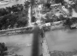
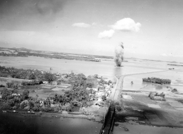
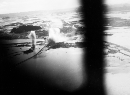
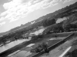
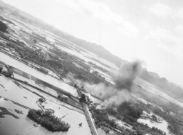
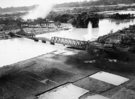
Large and inexplicable explosion near the Ninh-Bình railway bridge in French Indochina (Vietnam), during WWII. Ninh Bình is a small city in the Red River Delta of northern Vietnam, and along a critical rail route used by the Japanese. Coordinates: 20°15'39.7"N 105°59'06.3"E
Bombing of Ninh-Bình railway bridge in French Indochina (Vietnam), during WWII. Ninh Bình is a small city in the Red River Delta of northern Vietnam, and along a critical rail route used by the Japanese. Coordinates: 20°15'39.7"N 105°59'06.3"E
Aerial view of American B-25s over Canton (Guangzhou), during WWII.
Aerial view of rice paddies and karst mountains in SW China or Indochina, during WWII.
American B-25s of the Ringer Squadron in flight in the CBI during WWII.